GIS and geospatial services · Nigeria and AfricaGeospatial analysis you can verify.

I do GIS, remote sensing and earth observation, drone mapping and geospatial AI work for plantation operators, agric lenders, exporters, developers, governments and NGOs, in Nigeria and abroad. I turn imagery and location data into answers, and I tell you how far to trust each one.

Based in Lagos (WAT, UTC+1) · On site across Nigeria · Remote for clients anywhere · See the work

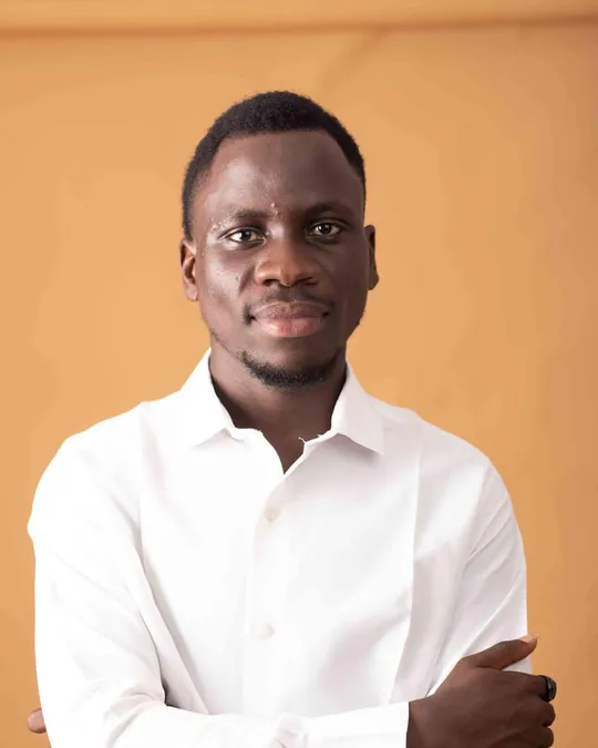
Portrait of Oluwasola Oyinloye
  • 718,751oil palms mapped across 12,166.6 ha for one plantation
  • 1,500people taught in Python-for-geospatial seminars
  • 1research publication (preprint)
  • 5years of professional GIS and remote sensing work

Selected work

Case studies

What I built and how far it has been tested.

  • Client work
  • Geospatial AI
  • Anonymised

Counting oil palms from aerial imagery

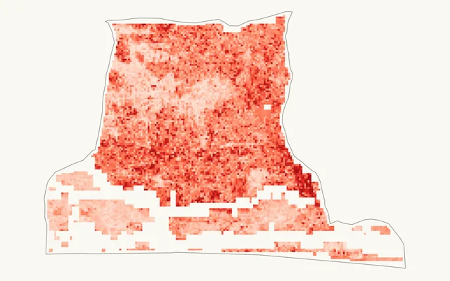
For a commercial oil palm plantation in West Africa, a YOLOv8 model finds each palm crown in aerial imagery and turns it into a mapped, countable tree, block by block. On held-out test tiles it counted 519 palms where a hand count found 518.

Blocks overlapped, so adding them up would count some palms twice. Plantation total:
Sum of block counts1,021,163
Each hectare counted once718,751

302,412 double counts removed (29.6%). Every hectare is attributed to exactly one block.

  • Public good
  • Spatial ML
  • Preprint

GeoAID flood susceptibility: Amuwo-Odofin pilot

A machine-learning model that maps which parts of Amuwo-Odofin are more prone to flooding, built on satellite data, published as a live dashboard and written up as a preprint.

How well the model tells flooded from dry locations (ROC-AUC, where 0.5 is a coin toss and 1.0 is perfect)
Random split≈ 0.798
Spatial cross-validation≈ 0.642

The spatial score tests the model on areas it never saw in training. The drop means it can point to areas worth checking, but it shouldn't decide anything about a particular site yet.

  • Public good
  • Spatial optimisation
  • DSN AI Bootcamp

Where to build next: connectivity sites for Nigeria

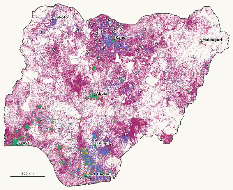
Built on Ookla's mobile speed tests, a 1 km map of what every part of Nigeria needs for broadband, and a choice of which clinics and schools should host new sites so that each one reaches as many unconnected people as possible.

Rural gap
66.0 M people with no speed test within 2 km
100 sites
reach 3.12 M of them
Checked
40 of 40 published numbers recomputed independently
  • In progress
  • Public good

Lagos Access Map

How complete is OpenStreetMap's record of health facilities in Lagos? The first phase audits it ward by ward against a reference list of known facilities.

Measures
Share of known facilities found, per ward, with a 95% confidence interval
Also
Facilities per km² and per 10,000 people
Results
Not yet. They will be published here.

Counts alone can't show completeness. A ward with few clinics on the map may simply have few clinics.

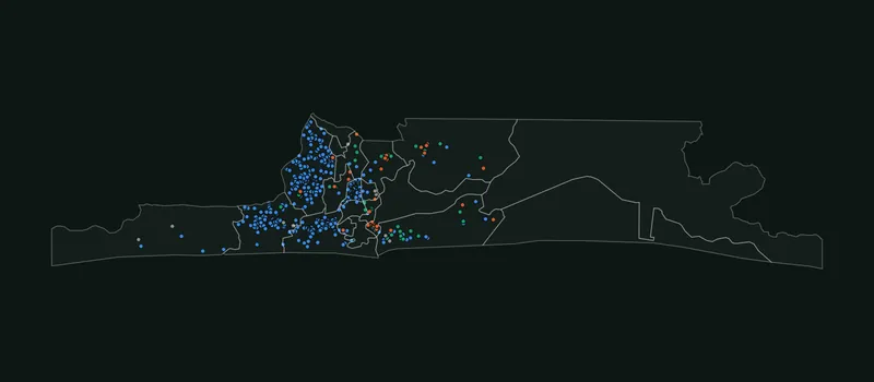
Static map of Lagos State's 20 LGAs with dots for each health facility tagged in OpenStreetMap; most dots sit in the western and central LGAs.

Hospital Clinic or doctor Pharmacy Other

What OpenStreetMap holds today: 605 health facilities across Lagos State's 20 LGAs, pulled 2 October 2026. Whether that is most of them or a fraction is what the audit will measure. Map data © OpenStreetMap contributors.

See the counts by LGA as a table
LGAHospitalClinic or doctorPharmacyOtherTotal
Alimosho181250188
Mushin103000103
Amuwo Odofin9000090
Ojo8201285
Eti Osa17314236
Kosofe1347024
Ìkòròdú456015
Shomolu432514
Lagos Island570012
Surulere70108
Oshodi/Isolo23207
Badagry40026
Ikeja21306
Lagos Mainland21306
Ajeromi/Ifelodun31004
Ifako/Ijaye00011
Agege00000
Apapa00000
Epe00000
Ibeju Lekki00000

Products

Open geospatial products

Free public tools I build and maintain alongside client work. Each one documents its data sources and known limits.

  • Live
    • Flood risk
    • Open source
    • Lagos

    GeoAID

    Where Amuwo-Odofin is structurally prone to flooding, whether rain is activating that risk now, and which people, schools, clinics and roads are exposed.

    ForPlanners, emergency responders, NGOs and researchers

  • In development
    • Health access
    • OpenStreetMap
    • Lagos

    Lagos Access Map

    The first phase measures how complete OpenStreetMap's record of health facilities is, ward by ward, so that any map of access to care starts from checked data.

    ForHealth planners, NGOs and the OpenStreetMap community

  • Next

    Your question, as a public tool?

    I build open products where good data can help many people at once. If you hold data, fund public-good work or have a question worth answering in the open, let's talk.

Who I work with

The questions clients bring

  • Plantation operators

    How many palms do we have, block by block, and where are the gaps?

    Tree counts and stand maps from drone surveys planned and flown in-house, or from satellite imagery.

  • Agric lenders

    Is this farm real, how big is it, and is it planted?

    Farm boundary, area and crop checks from satellite imagery, before and after you lend.

  • Exporters and cooperatives

    Can we show EU buyers that our plots weren't deforested after 2020?

    Plot geolocation checks and deforestation screening for the EU Deforestation Regulation.

  • Developers

    How prone to flooding is this site, and what sits around it?

    Flood susceptibility and exposure screening before you buy, design or build.

  • Government agencies

    Where are people and assets exposed, and where should services go next?

    Flood exposure, access to services and land-cover change, with the data and code your team keeps.

  • NGOs

    Who is far from a clinic, and can we trust the map data?

    Access and coverage maps, and audits of the data your programme relies on.

Industries I work with

  • Agriculture and plantations
  • Banking, insurance and agric lending
  • Energy and utilities
  • Oil, gas and mining
  • Real estate, construction and infrastructure
  • Transportation and logistics
  • Telecoms
  • Retail and consumer goods
  • Government and public sector
  • Healthcare
  • NGOs and international development
  • ESG, environment and climate
  • Education and research
  • Consultancies and engineering firms

Where I work

  • Nigeria

    On site

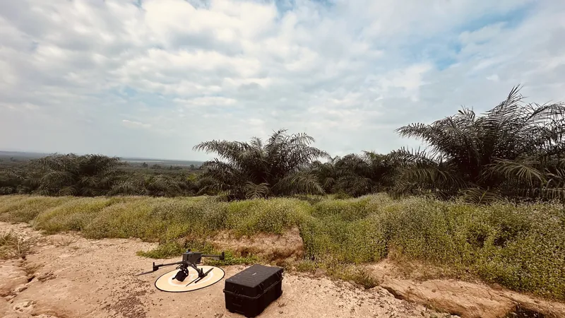
    Drone surveys planned and flown in-house, GNSS ground control and field checks, through to analysis and delivery.

  • Across Africa

    Remote, satellite first

    Open satellite data covers the whole continent, so work on land cover, vegetation, flood risk or change over time can start without a site visit.

  • Worldwide

    Remote, on your schedule

    We agree the scope in writing, I send regular updates, and you get standard formats (GeoTIFF, GeoPackage, PostGIS) with the code. Lagos time (UTC+1) overlaps most of the European working day and the morning in the Americas.

Services

GIS and geospatial services

10 service areas, from drone surveys and site selection to EUDR checks and training, for clients in any industry. Choose yours to see where I can help.

Also: cartography and map production for reports, digitising and data cleaning, geocoding, OpenStreetMap mapping, site suitability studies and GNSS ground control. If your question involves a place, ask.

Tools I work with

Programming and analysis

  • Python
  • SQL
  • Jupyter
  • pandas
  • NumPy
  • SciPy
  • statsmodels

Machine learning and AI

  • PyTorch
  • Ultralytics YOLOv8
  • scikit-learn
  • XGBoost
  • SHAP
  • OpenCV

Earth observation

  • Google Earth Engine
  • geemap
  • Sentinel-1 SAR
  • Sentinel-2
  • SRTM
  • CHIRPS
  • NASA GPM IMERG
  • ESA WorldCover
  • WorldPop

GIS and spatial data

  • QGIS
  • Google Earth Pro
  • PostGIS
  • GeoPandas
  • Rasterio
  • Shapely
  • PyProj
  • OpenStreetMap

Drone mapping

  • DJI Terra
  • Agisoft Metashape
  • WebODM / OpenDroneMap
  • GNSS ground control

Dashboards and web maps

  • Streamlit
  • Power BI
  • Plotly
  • Folium
  • Leaflet

Process

How I work

  1. Scoping call

    A 15- or 30-minute call: you tell me the decision you need to make, and I tell you whether spatial data can help and what it would take.

  2. Pilot on your data

    I test the approach on a small part of your area and report its error rate, so you can judge it before you commit.

  3. Delivery you keep

    You get the results, the code that produced them and documentation your team can follow.

Engagements

Ways to work together

Pick the shape that fits your budget and how sure you are of the approach.

  • Pilot

    A fixed-scope test on part of your area. You see the method, the output and its error rate before you commit to the full job.

  • Project

    A defined deliverable, such as a tree inventory, a flood screening or a web map, against a written scope, timeline and acceptance criteria.

  • Monitoring

    The same analysis repeated monthly, by season or by year, for programmes and portfolios that need to track change.

  • Advisory and strategy

    Strategic and technical advice by the day or month: what to build or buy, a review of your data and methods, or a geospatial specialist for your bid.

  • Training

    Workshops built around your team's own data, in person in Nigeria or online.

Every engagement starts with a written scope. NDA on request. How I handle your data

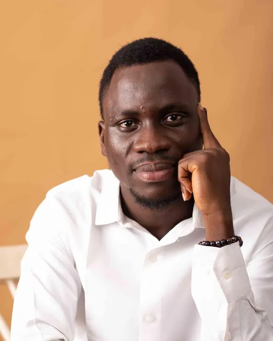
Oluwasola Oyinloye seated, smiling, in a white shirt

About

Hello, I'm Oluwasola

I'm Oluwasola Oyinloye, a geospatial data scientist and geospatial AI specialist based in Lagos.

I trained in Surveying and Geoinformatics at the University of Ilorin (BSc), then earned a Master of Information Technology (MIT) with an AI specialisation from Miva Open University.

I have five years of professional GIS and remote sensing work behind me, and I have taught Python for geospatial analysis to 1,500 people through seminars.

I take on drone surveys in Nigeria, planned and flown in-house, and work remotely from satellite data for clients across Africa and beyond.

I report how every result was validated, including when the numbers are less flattering. Alongside client work, I build free public tools like the Lagos Access Map and GeoAID, which is written up as a preprint.

Education
BSc Surveying and Geoinformatics, University of Ilorin
Master of Information Technology (MIT), AI specialisation, Miva Open University
Work with
Satellite, drone and aerial imagery · spatial machine learning · GIS
Clients in
Nigeria (on site) · Africa and worldwide (remote)

Contact

Book a call

Tell me what you need to decide, where, and what data you already have. I'll tell you plainly whether I can help. Book 15 minutes to introduce yourself or 30 to scope a project, at a time shown in your own time zone. If you'd rather write, the email opens with a short template.

Oluwasola Oyinloye

You'll speak with me directly.Lagos, Nigeria · WAT, UTC+1

Book a call